
Image Credit: NASA, JPL
Space radar image of Wadi Kufra, Libya. A previously unknown branch of an ancient river, buried under thousands of years of windblown sand in a region of the Sahara Desert in North Africa. This area is near the Kufra Oasis in southeast Libya.
 Image Credit: NASA, JPL
Space radar image of Sunbury, Pennsylvania showing the geologic structure of the area.
 Image Credit: NASA, JPL, Visible Earth Team.
Western Pacific rain clouds, the image shows the ocean surface in a portion of the Western Pacific Ocean. Scientists are using images like this to study the occurrence, distribution and activity of tropical rain squalls and to understand the exchange of heat between the atmosphere and ocean.
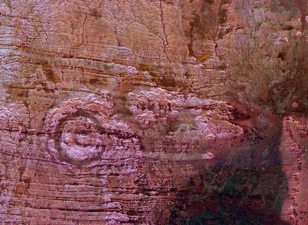
Image Credit: NASA, JPL, Visible Earth Team.
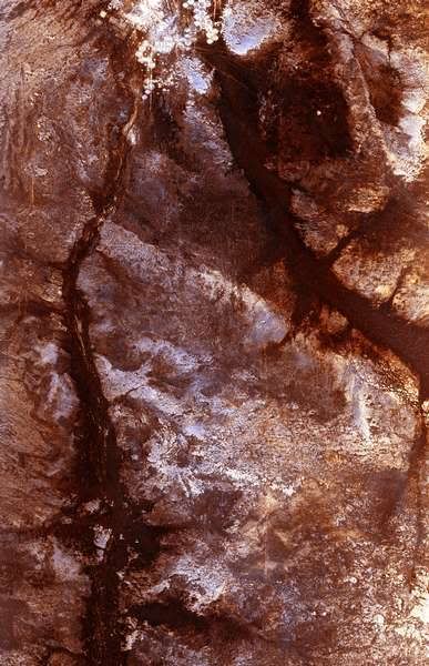
Aorounga impact crater, Sahara Desert, northern Chad.
Space Radar Image of Safsaf Oasis, Egypt. Scientists are using the penetrating capabilities of radar imaging in desert areas in studies of structural geology, mineral exploration, ancient climates, water resources and archaeology.
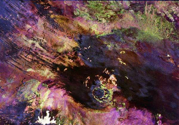
Image Credit: NASA, JPL, Visible Earth Team.
Image shows the Roter Kamm impact crater in southwest Namibia. The crater rim is seen in the lower center of the image as a radar-bright, circular feature. Geologists believe the crater was formed by a meteorite that collided with Earth approximately 5 million years ago.
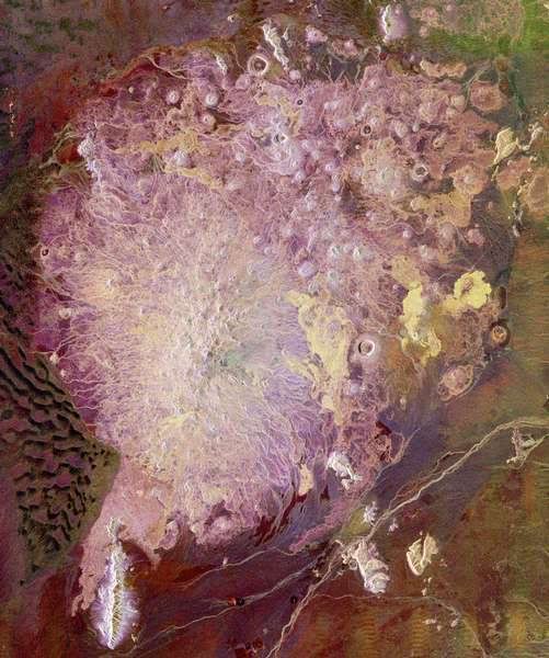 Image Credit: NASA, JPL,Visible Earth Team.
Satellite image of the Pinacate Volcanic Field in the state of Sonora, Mexico, about 150 kilometers (93 miles) southeast of Yuma, Arizona, More than 300 volcanic vents occur in the Pinacate field. The United States/Mexico border runs across the upper right corner of the image.
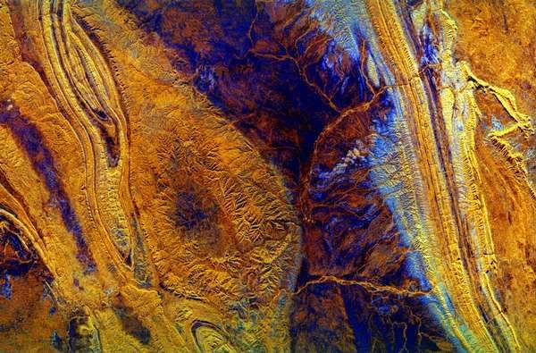 Image Credit: NASA, JPL, Visible Earth Team.
Palm Valley, Australia. This space borne radar image shows mountains and valleys in the arid landscape of central Australia. The mountains are part of the MacDonnell Ranges in the Northern Territory of Australia, just west of the town of Alice Springs.
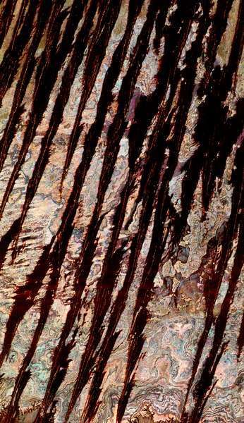 Image Credit: NASA, JPL, Visible Earth Team.
Egyptian Sand Dunes. This three-frequency space radar image of west central Egypt shows detailed patterns of eroded sedimentary rock formations emerging through a vast sea of sand dunes. The broad black bands that dominate the image are thick ridges of sand known as longitudinal dunes. In this region of the Sahara, a single ridge may be as long as several hundred kilometers. Thin red lines within the black bands are bright reflections from the steep crests of the sand ridges. Between the dunes are colorful patterns of rock outcrops that are either exposed at the surface or covered with very thin layers of sand.
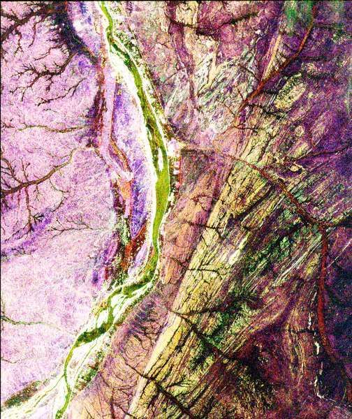
Image Credit: NASA, JPL, Visible Earth Team.
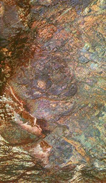
Space Radar Image of Sudan Collision Zone. This image of a region in northern Sudan called the Keraf Suture that reveals newly discovered geologic features buried beneath layers of sand. The Nile is the yellowish/green line that runs from the top to the bottom of the image. A small town, Abu Dis, can be seen as the bright, white area on the east (right) bank of the Nile.
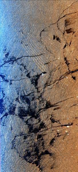 Image Credit: NASA, JPL, Visible Earth Team.
radar image of an offshore drilling field about 150 km (93 miles) west of Bombay, India, in the Arabian Sea. The dark streaks are extensive oil slicks surrounding many of the drilling platforms, which appear as bright white spots.
 Image Credit: NASA, JPL, Visible Earth Team.
South Polar Projection of Earth. This image was created by mosaicing together several images taken by Galileo over a 24 hour period and projecting them as they would be seen from above the pole.
 Image Credit: NASA, JPL, Visible Earth Team.
Space Radar Image of Oetzal, Austria. This image is shows the Central Alps at the border between Switzerland, Italy and Austria, 50 kilometers (31 miles) southwest of Innsbruck.
More Information.


No comments:
Post a Comment